GIS (Geographic Information System) - Online Project-based Course

Learn GIS hands-on with Q-GIS software

Certificates:
Will be given on completion

Doubts clarification:
1-to-1 Sessions with our experts on Skype/Chat.

Complete Before:
45 days from the date of enrollment
(takes 16-20 Hrs to complete)


Build Together. Pay Less! On discount now! Valid till 03 Sep
No of Team Members54321
Price per student ₹ 1399
₹ 1279
₹ 1499
₹ 1349
₹ 1665
₹ 1465
₹ 1999
₹ 1699
₹ 2999
₹ 2399
Outside India? click here
100% refund if not satisfied.
Enroll Now
(Net Banking/Credit Card/
Debit Card)
Try it Free
(First few chapters free)

About GIS (Geographic Information System) Online Project-based Course

You will start learning by creating a simple map and then create a complex park map with the help of total station data. And finally, perform the data processing operation to transform local data into global data. By doing this course you will learn about:

  1. Data processing & manipulation
  2. Shortest distance finder
  3. Affine transformation
  4. Geo processing & contour creation
  5. Processing real-time GPS data

How to do the Online Course?

Learn and Develop GIS (Geographic Information System) Project in 3 Steps

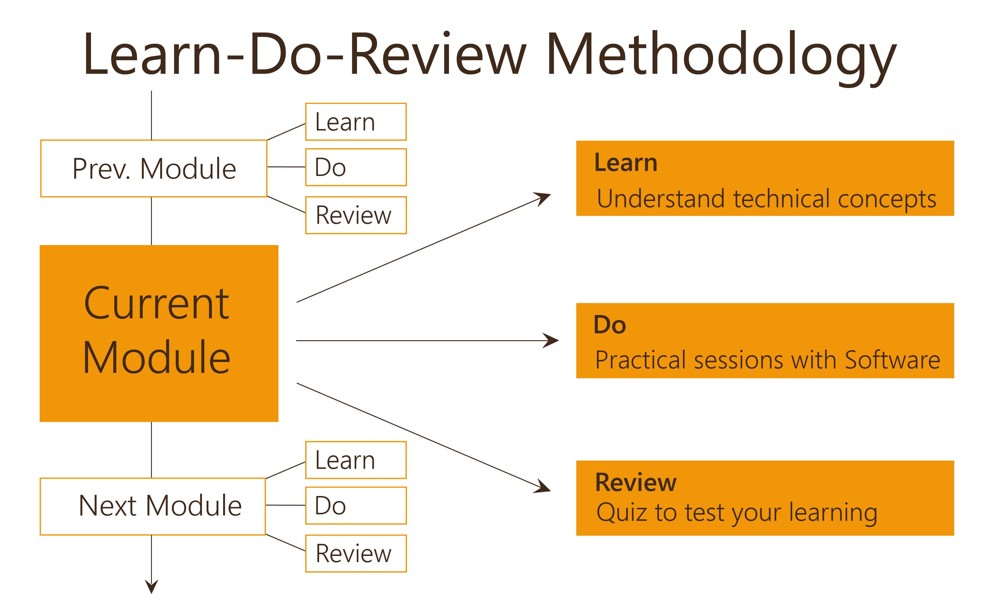
Login to our Online Learning Portal will be provided instantaneously upon enrolling. This Portal gives you access to video lectures, tutorials and quizzes required to develop your foundation design project. As you complete the course your project will also be completed.

About Online Course

Features

FeaturesClassroom TrainingOnline project based course
Doubt Clarification1 trainer to 40 studentsPersonal 1-to-1 session (Video/Chat) with our experts
Duration16 Hrs Fixed16 Hrs at your own pace (Complete within 45 days)
VenueFixedAnywhere as per your convenience
Additional cost for studentTravel, Accommodation to reach the venueNo additional costs
RefundOnly before training program startsAnytime if you don't like the course
Revision Using study material in pdf formatSee the video lectures/tutorials any number of times
Pause & ResumeNot possiblePause and resume any number of times
Module Size2 hour lecture3 min videos which will allow you to take breaks
Hands-on session1 trainer to 40 studentsHigh clarity videos showing clear steps which can be reviewed any number of times
CertificationUpon Completion Upon Completion
Study MaterialPDF format (Online)Excellent Video based lectures and tutorials
ExaminationOnline at extra fee (Rs. 299)Inbuilt in the course

Course Structure


  • Learn: Introduction to GIS
  • Do: Software installation - QGIS: Do
  • Do: Exploring QGIS software
  • Learn: What is GIS
  • Learn: Applications of GIS
  • Learn: GIS process
  • Review: Introduction to GIS
  • Learn: Coordinate reference systems
  • Learn: GIS data
  • Do: Creating a simple map - part 1
  • Do: Creating a simple map - part 2
  • Do: Creating a simple map - part 3
  • Review: Coordinate reference systems
  • Do: Create a park map - Part 1
  • Do: Create a park map - Part 2
  • Do: Create a park map - Part 3
  • Learn: Affine transformation
  • Do: Working with project data - part 1
  • Do: Working with project data - part 2
  • Do: Working with project data - part 3
  • Do: Working with project data - part 4
  • Do: gvSIG software installation
  • Do: Computing affine transformation values
  • Review: Affine transformation
  • Do: Data manipulation - Alaska raw data - part 1
  • Do: Data manipulation - Alaska raw data - part 2
  • Do: Working with attribute data: Do
  • Do: Different data collection methods
  • Do: Contour mapping
  • Do: Finding the shortest path using GIS
  • Do: Finding an optimal location using GIS - Part 1
  • Do: Finding an optimal location using GIS - Part 2
  • Review: Different data collection methods
  • Learn: Introduction to GPS
  • Do: Collect GPS data using an App
  • Do: Working with GPS data
  • Review: GIS - Final problem

Team Size and Certification

  • A team can have maximum of 5 members
  • All members will get logins
  • Certificate of Completion will be provided to each team member as soon as the member completes the course

All Skyfi Labs certificates come with a unique ID which can be verified online for authentication.

Eligibility

Anybody interested to learn GIS can take up this project-based course. Anyone interested in learning Q-GIS software can also take this course.

Why Civil Simplified?

  • Civil Simplified is a division of Skyfi Labs that develops courses with a focus on Civil Engineering disciplines.
  • Awards won by us:
    • 2nd Best Business Venture Award, Ideas, IIT Kanpur
    • 30 Most Promising Startups, Next Big Idea, IIM Bangalore
    • Runner-up, UnLtd India Growth Challenge
    • Limca book of records
  • Associated with industry and partnership with organizations transforming engineering education
  • Our courses are officially a part of IIT Delhi Syllabus and IIT Kanpur orientation programs
  • Experience of training students across 27 states in India and Dubai (Presence)
  • Improved performance of students in Campus Placements
  • A venture by IIT Kanpur alumni and funded by The Chennai Angels and Spark Capital

Have any concerns?

View FAQs

Contact Details

Please feel free to contact us in case of any queries.
Email: info@civilsimplified.com
Phone: 18001237177 (10AM - 8PM; Mon - Sat)

Registrations

Enroll Now
(Net Banking/Credit Card/
Debit Card)
Try it Free
(First few chapters free)

Leave your comments below..

Can't attend Online?

Other Popular Civil Engineering Workshops..